Thursday, June 11, 2015

Killarney Provincial Park - canoe trip

After several changes of plans, this trip ended up being shorter than expected, but was still enjoyable -  some nice parts, some not so nice parts, but overall it was a good time. There ended up being three of us who went: my cousin Greg, my friend Tyler, and I. We used one canoe and borrowed a kayak from another friend. Arriving at Killarney Provincial Park around mid-day on Thursday, we didn't really have a planned route. This was cause for amusement for the staff at the park office as we consulted them extensively for their opinions, argued amicably among ourselves, and generally flip-flopped back and forth for some time before finally deciding on our final plan. At this point, I'm not even sure what that plan was, since we didn't quite follow it. The office also held one small item which Tyler bought and later exclaimed was one of the best purchases he had ever made: a bug net for his head! We strongly urged him to buy it, and he reluctantly agreed.

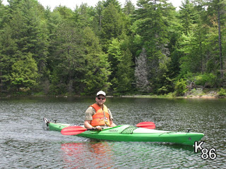
However, we did start as planned, which was to launch in Johnnie Lake and portage into Ruth-Roy Lake, where we would camp at one of the two sites there. The first launching of our boats did not bode well as far as bugs go! The mosquitoes and little black flies outnumbered us hundreds to one, and began their attack immediately; it took several minutes of fierce paddling to finally lose them. I was in the kayak for the whole trip except one day trip we made. It didn't take long for me to realize kayaking wasn't my favourite mode of water travel. I've never spent much time in kayaks, so that may have influenced my experience, but there were several aspects I didn't enjoy. I found it cramped in the cockpit; there is little freedom of movement to get comfortable, and after sitting in one position for some time, there really isn't the option of shifting to another position. Paddling a kayak is the same repetitive motion all the time with no opportunity to change. Unless the group agrees to stay together, you're on your own with no one to talk to. I much prefer a canoe, where there is plenty of room to move about and stay comfortable, one can switch sides, grips, or sitting positions if paddling gets tiring, and there's always the other person in the canoe to talk to unless you're going solo. I found all those things to be true on this trip, and was often some distance away from the other guys, hearing them talking and feeling a bit left out. It didn't help that I'm wasn't very quick in the kayak either, so I couldn't easily catch up or keep up to them to join in the conversation.

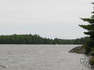
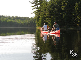
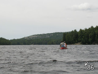
Killarney Provincial Park - canoeing on Johnnie Lake

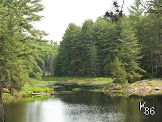
Killarney Provincial Park - Johnnie Lake

Killarney Provincial Park - Johnnie Lake

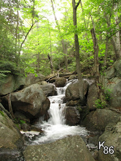
Killarney Provincial Park - waterfall along Johnnie Lake to Ruth-Roy portage

Killarney Provincial Park - waterfall along Johnnie Lake to Ruth-Roy portage

The route to Ruth-Roy had one short portage. Once again the mosquitoes came for us, but we still spent a little time exploring the small creek between the lakes and took some pictures at a nice, small waterfall. We were welcomed to our campsite by a heartily singing sparrow, and another small army of mosquitoes! As we discovered later, the campsite was just around the corner from a marshy area, as well as some large swamps and marshes a short distance away. After setting up our camp, we still had enough time to do some exploring across the lake, trying to find Bunnyrabbit Lake, which one of the park staff had said was a beautiful lake. Upon reaching the top of the cliffs we had seen from the campsite the mosquitoes were much better, however the black flies took their place quite effectively; bug nets were essential most of the time. To find the lake we had to bushwhack, and though we had a map and compass, and though some would deny it, we did arguably get lost for a time. It has never been concluded whether we actually saw Bunnyrabbit Lake, nor has it ever been truly concluded who was right and who was wrong about where we were and how we were to get back to the lake, but we did make it there, and with still enough light to cook supper. Unfortunately, as the evening drew to a close, rain began to fall, driving us to the tent for the night. The rain was steady, heavy at times, and lasted well into the next day.

Killarney Provincial Park - Ruth-Roy Lake damselfly bush

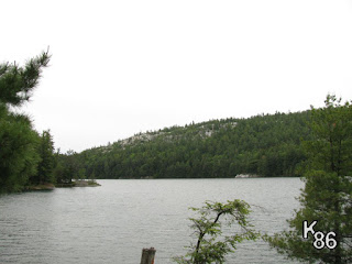
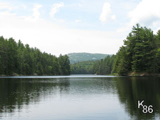
Killarney Provincial Park - Ruth-Roy Lake


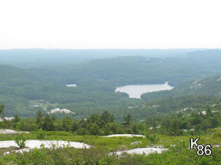
Killarney Provincial Park - panoramic view of Ruth-Roy Lake

Killarney Provincial Park - view of Ruth-Roy Lake

Killarney Provincial Park - hiking above Ruth-Roy Lake

Killarney Provincial Park - hiking with bugnets above Ruth-Roy Lake

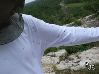
Killarney Provincial Park - blackflies at Ruth-Roy Lake in June

Killarney Provincial Park - blackflies at Ruth-Roy Lake in June

When morning arrived, we awoke to the steady whine of hundreds of mosquitoes. They were everywhere surrounding our tent, between the rainfly and the screen. It was quite incredible! While waiting for the rain to go, we played cards, dozed, and ate snacks, and were generally lazy until finally the sun came out in the early afternoon. Our planned route was now definitely out of the question, since we only had a couple hours of the day left in which to paddle, so we decided to paddle back into Johnnie, and then into Bell Lake, seeing how far we could make it. Despite a couple more mosquito-ridden portages, it was nice to be on the water in the sun. We were able to make it to a wonderful site on Bell Lake, right at the tip of a point. It was very nearly an island, being almost completely cut off from the rest of the land by a marsh. A perfect breeze was blowing across the point through the trees. The breeze kept up almost the whole time we were at the site, driving all but a few mosquitoes from our site - a pleasant change. We were also thankful for the breeze to dry out some of our gear which got a bit wet from the rain.

Killarney Provincial Park - canoeing on Bell Lake

Killarney Provincial Park - start of sunset on Bell Lake

Killarney Provincial Park - marsh near campsite on Bell Lake

Killarney Provincial Park - setting up campsite on Bell Lake

One little activity I enjoy on camping trips is going down to the water's edge at night with a good flashlight or headlamp. It is often quite busy underwater, and this time we were able to see some good size crayfish, several frogs, a watersnake, some turtles, and probably several other critters. On one of our nights at this site, we decided to investigate the chorus of bullfrogs coming from the marsh behind us. Slipping into the canoe, we paddled as quietly as possible into the marsh, and were surrounded by croaking bullfrogs. It was an amazing experience to hear their voices all around us in the darkness!

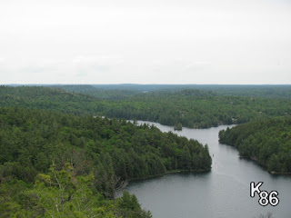
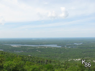
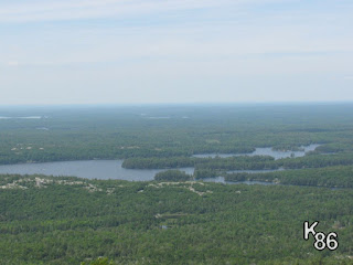
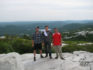
On Saturday, we decided to go for a day trip and hike to the top of Silver Peak the highest point in the park. Getting there meant we needed to paddle a short distance, and Greg thought he would try the kayak for part of it. He's a bigger guy than I am, and his experience was consequently more unpleasant than mine. If I'm remembering right, there was a fair bit of water in the kayak for a few moments! The hike up Silver Peak was moderately challenging. Portions of the trail were quite steep at times, though fortunately the higher we got, the bugs became less of an added problem. There were several streams we followed for short sections. As we neared the top, we met several people around our age who were impressed with, but also quite jealous of our bug nets. At the top of Silver Peak, we were able to see a great distance all around, viewing much of the white rock for which Killarney is known, and also many lakes. We could even see Georgian Bay to the south, and the smokestacks of the mines at Sudbury to the east. Hiking back down was a strain on the knees. It seemed easier to travel faster, because of which an unfortunate stumble led to Greg's infamous "Long Fall", in which he stumbled another 30 feet or more as he tried valiantly to keep his balance and to resist falling to the ground! Unfortunately his efforts were unsuccessful, though no serious injuries were sustained.

Killarney Provincial Park - Silver Peak in the distance

Killarney Provincial Park - kayaking to Silver Peak

Killarney Provincial Park - looking out from Silver Peak part way up

Killarney Provincial Park - looking out from Silver Peak part way up

Killarney Provincial Park - tiny waterfall on trail up Silver Peak

Killarney Provincial Park - tiny waterfall on trail up Silver Peak

Killarney Provincial Park - view from atop Silver Peak

Killarney Provincial Park - view from atop Silver Peak

Killarney Provincial Park - view from atop Silver Peak

Killarney Provincial Park - view from atop Silver Peak

Killarney Provincial Park - white rock atop Silver Peak

Killarney Provincial Park - white rock atop Silver Peak

Killarney Provincial Park - view from atop Silver Peak

Killarney Provincial Park - view from atop Silver Peak

After another enjoyable evening at our campsite, we retreated to the tent, ready to pack up the next morning and head back to the car. Though the trip back on Sunday was uneventful, the weather was not pleasant, with wind and some slight rain. We ended up stopping at the second last portage, which was another entry point, and I got a ride back to the car.

This was a good trip, and a great introduction to Killarney Provincial Park for me.
Monday, June 8, 2015

Coopers Falls Trail - Solo hiking trip

This was a bit of a last minute trip, the first hiking trip I had done, and also the first time going solo. A couple friends and I had been planning a canoe trip in Killarney for a week, so I had booked the whole week off. After several changes of plans, we ended up only going to Killarney from Thursday to Sunday, which left me the option of either going in to work for the first several days of the week, or doing something with the time off. I had wanted to try a camping trip on my own, but was a bit hesitant and didn't have a good opportunity...well, this provided me with the opportunity so I decided to go for it. I looked on the Ontario Crown Land Use Policy Atlas (CLUPA) for some crown land that was nearby and found this section of the Trans-Canada Trail called the Coopers Falls Trail, which lies on crown land just outside the hamlet of Coopers Falls, southeast of Gravenhurst. I planned to hike north and east up the trail, camp for one night, continue until the trail met Houseys Rapids Road, and then hike back along the roads.

Driving in to the trail head, I was thankful for my new vehicle, a Subaru Forester, since it was a pretty steep and rough entrance. Once I found a good spot to park, I realized that getting changed into my hiking clothes would need to be done inside my vehicle - hordes of mosquitoes had already surrounded me, and I was not about to expose any skin to them if possible! Fortunately, I had a long sleeve shirt, pants, and a bug net for my head. All dressed and packed, I started hiking the trail. The area is not really flat, but there are no real extremes - hills are small and not very steep. The landscape is all built upon rock. After hiking a little while, I also discovered that this area has a lot of beaver activity; I saw several beavers and many lodges and dams. The variety of ponds and streams made for many interesting and wonderful views.


As evening neared, I was having difficulty for several reasons deciding on the best place to make camp. I like best a site near water, preferrably a pond or lake. I wanted to find an existing location that would make a good site, to minimize my impact on the area. There were no spots that stood out as an obvious choice in terms of the view they offered. As well, I didn't want to spend too long hiking back and forth trying to pick the best one. The spot I settled on straddled the trail, with a small, moss-filled hollow on one side for my tent, and a shallow, rocky slope down to a beaver pond on the other. This rocky slope was perfect for sitting and having a small campfire over which to cook dinner.


 Another first for this trip: I was able to test a collapsible campfire grill I had created. It worked out wonderfully, though I realized that I would want to make a smaller, lighter version for solo trips. The noises of the wild were so enjoyable while sitting at the fire - there was a constant, indiscernible background track of crickets, frogs, and other insects, as well as the incessant call of the whippoorwill. Some time after darkness, a slight rain started, making it a good time to head to the tent for the night. Those enjoyable sounds by the campfire did start to get tiring...especially the whippoorwill, which I've discovered doesn't really stop!


After having breakfast and packing up the next morning, I started off toward the road. I had hiked about 75% or more of the trail, but the last portion turned out to be the most difficult. There were several marshy or swampy sections, one with a "boardwalk" which sagged when walked upon, but the last which had none. The marking of the trail was not excellent from the start, but in this last swamp it was even more poorly marked. I ended up losing the trail in the swamp while trying to follow the markers while also trying to stay out of the water and mud by jumping between the hummocks. At this point I knew the road was due east, so I just followed my compass and pressed through the forest. It wasn't too difficult and I found the road with little problem.

The hike back on the road was not very exciting, but the scenery was still interesting. The second road, heading back to the west, paralleled the Black River. This river is aptly named as the water is slow moving and very dark. In fact much of the water in this area seems to have a darkish tint to it, somewhat brown.


I returned to my car with a little more time than I expected, so I thought I'd explore to see if I could find the water feature for which I presumed Coopers Falls was named. Having studied several maps before the trip, I was quite sure I had seen a marking for a waterfall, and while I could hear what sounded like the noise of falls, I was not able to get a view of them. I did however get to share the road with a good size (16-18" long shell) snapping turtle !

On a later trip with my nephew, we tried again to find the falls, this time with success. There is one small window through the forest while driving through which you can glimpse the falls.


The trip was a good trip of firsts, though not without some learning:
  • I needed to get some proper shoes or boots for hiking.
  • My 3-person, Canadian Tire tent, though actually a fairly nice tent which I still like, is definitely too heavy and large for a solo trip.
  • Lightening up my pack in other areas would need to be something to work on.
  • Bugs are bad in the beginning of June. A lighter weight, long-sleeve shirt would be good, and also making sure that the back of my shirt doesn't ride up from my pack, exposing my lower back to hungry black flies.